English
  Tiếng Việt
 ⛅ Weather Satellite: Disaster Forecasting and Monitoring
In the context of increasing natural disasters and climate change, weather satellites play a crucial role in accurate forecasting and early warning of dangerous phenomena. From monitoring storms to tracking wildfires, these satellites have significantly contributed to protecting people and their living environments.
- How to Optimize the Signal of a Satellite WiFi Repeater in an Urban Environment
- Satellite Hub for Defense Organizations: Applications and Standards
- How Many Users Can Use A Satellite WiFi Extender At The Same Time?
- Satellite Hotspot and Satellite Phone: Comparing Key Features
- Hotspot vệ tinh có bền vững không? Những điều cần cân nhắc
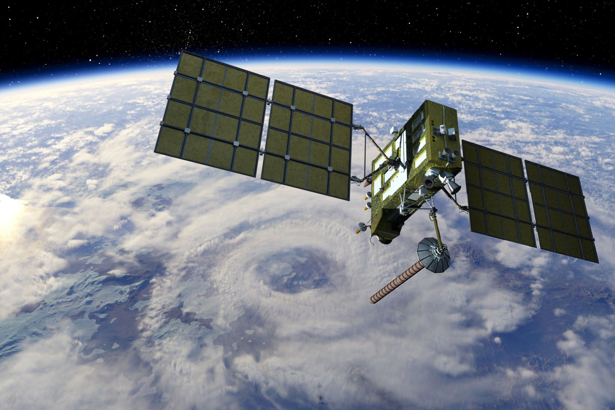
Weather satellites
🛰️ 1. What is a Weather Satellite?
Weather satellites are specialized satellites launched into Earth's orbit to:
-
Observe the atmosphere and weather conditions
-
Record images, temperature, humidity, wind speed, etc.
-
Assist meteorologists in making more accurate forecasts
🔭 These satellites use modern sensors to collect real-time data, thereby analyzing weather patterns over a wide area.
🌤️ 2. Forecasting Satellites – Supporting Accurate Weather Prediction
Forecasting satellites help to:
-
Observe clouds, rainfall, sea surface temperature
-
Provide continuous information on atmospheric changes
-
Support the development of short-term and long-term weather forecasting models
🎯 Thanks to this data, meteorological stations can issue warnings of heavy rain, heat, tropical depressions, etc.early and accurately.
🌪️ 3. Meteorological Satellites – Monitoring the Environment from Space
Not only for weather forecasting,meteorological satellitesalso help:
-
Track global climate change
-
Measure atmospheric temperature, humidity, gas composition
-
Detect unusual phenomena such as El Niño, La Niña, rising CO₂ levels...
🌏 This is an important tool for environmental research and shaping Earth protection policies.
🚨 4. Disaster Monitoring Satellites – Early Warning, Damage Mitigation
When disasters occur such as:
-
Typhoons, floods, droughts
-
Wildfires, earthquakes
-
Volcanic eruptions...
🛰️ Satellites quickly detect abnormal fluctuations and send early warnings to relevant authorities, helping to:
-
Map disaster risks
-
Guide citizen evacuation
-
More effective coordination of rescue forces
📍 For example: During a storm, satellites can trackits path – speed – wind intensityand send hourly warnings.
✅ 5. Lợi Ích Khi Sử Dụng Vệ Tinh Trong Dự Báo & Giám Sát
| Key Benefits | Brief Description |
|---|---|
| 🎯 More accurate forecasting | Early and specific regional warnings for rain, wind, storms, tornadoes... |
| 🔄 Continuous monitoring | Real-time data updates, 24/7 |
| 📉 Minimize damage | Allows for advance preparation for natural disasters: evacuation, reinforcing structures... |
| 📊 Support scientific research | Climate analysis, supporting policies to cope with climate change |

Forecasting satellites
🔚 Conclusion
Weather satellites, forecasting satellites, and vệ tinh giám sát thiên tai là “tai mắt trên bầu trời”, giúp con người chủ động hơn trước những rủi ro thiên nhiên. Với sự phát triển công nghệ hiện đại, chúng ta không chỉ dự báo được thời tiết hôm nay – mà còn có thể chuẩn bị cho tương lai an toàn hơn.
🔗 Bạn quan tâm đến thiết bị vệ tinh dùng trong cảnh báo sớm, khí tượng, cứu hộ thiên tai?
Visit 🌐 Website: để được tư vấn chuyên sâu!