 Tiếng Việt
  Tiếng Anh
 Vệ tinh viễn thám trong nông nghiệp đang trở thành công cụ quan trọng trong thời đại canh tác thông minh. Nhờ dữ liệu thu thập từ không gian, người làm nông có thể theo dõi đồng ruộng trên diện rộng. Việc quản lý cây trồng, đất đai và nguồn nước cũng trở nên chính xác hơn.
Trước đây, nông dân phải kiểm tra ruộng vườn chủ yếu bằng kinh nghiệm và quan sát trực tiếp. Cách này tốn thời gian, đặc biệt với diện tích canh tác lớn. Ngày nay, dữ liệu vệ tinh giúp phát hiện nhiều vấn đề sớm hơn.
Bài viết này sẽ giải thích vệ tinh viễn thám là gì và có ứng dụng ra sao trong nông nghiệp. Nội dung cũng phân tích lợi ích, hạn chế và xu hướng phát triển của công nghệ này trong tương lai.
Vệ tinh viễn thám trong nông nghiệp là gì?
Vệ tinh viễn thám trong nông nghiệp là việc sử dụng vệ tinh để quan sát, thu thập và phân tích dữ liệu về cây trồng, đất đai và môi trường canh tác. Vệ tinh không cần tiếp xúc trực tiếp với ruộng đồng. Thay vào đó, thiết bị cảm biến sẽ ghi nhận dữ liệu từ xa.
Dữ liệu có thể đến từ cảm biến quang học, hồng ngoại hoặc radar. Mỗi loại cảm biến có vai trò khác nhau. Cảm biến quang học giúp quan sát hình ảnh bề mặt. Hồng ngoại hỗ trợ đánh giá sức khỏe cây trồng. Radar có thể quan sát trong điều kiện mây hoặc ánh sáng yếu.
Sau khi thu thập, dữ liệu được xử lý thành bản đồ hoặc chỉ số nông nghiệp. Người dùng có thể xem khu vực cây phát triển tốt, khu vực thiếu nước hoặc vùng có dấu hiệu bất thường. Đây là nền tảng quan trọng của nông nghiệp chính xác.
Vì sao nông nghiệp cần vệ tinh viễn thám?
Nông nghiệp phụ thuộc nhiều vào thời tiết, nước, đất và sâu bệnh. Nếu không theo dõi kịp thời, thiệt hại có thể xảy ra rất nhanh. Một khu vực thiếu nước hoặc nhiễm bệnh có thể lan rộng trước khi được phát hiện.
Vệ tinh viễn thám trong nông nghiệp giúp quan sát diện tích lớn trong thời gian ngắn. Điều này rất hữu ích với trang trại, vùng sản xuất tập trung hoặc khu vực khó khảo sát trực tiếp. Dữ liệu vệ tinh giúp người quản lý nắm tình hình tổng thể hơn.
Công nghệ này cũng giúp giảm phụ thuộc vào phỏng đoán. Quyết định tưới nước, bón phân, phun thuốc hoặc thu hoạch có thể dựa trên dữ liệu. Nhờ đó, sản xuất nông nghiệp có thể tiết kiệm hơn và bền vững hơn.
Vệ tinh viễn thám hoạt động như thế nào?
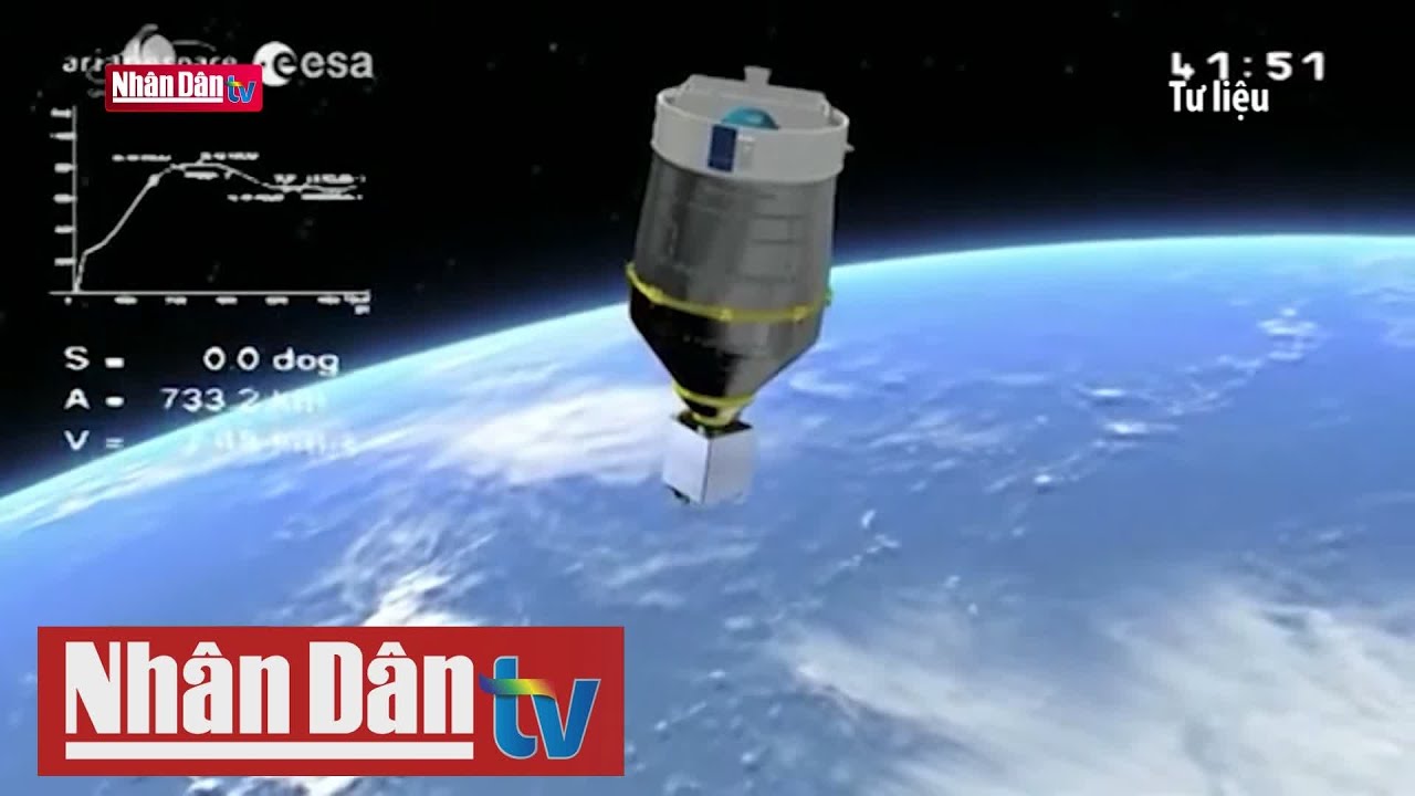
Vệ tinh bay quanh Trái Đất và sử dụng cảm biến để ghi nhận dữ liệu bề mặt. Dữ liệu này có thể là hình ảnh, nhiệt độ, độ ẩm, phản xạ ánh sáng hoặc tín hiệu radar. Sau đó, dữ liệu được truyền về trạm mặt đất.
Hệ thống xử lý sẽ phân tích dữ liệu và tạo ra bản đồ chuyên đề. Trong nông nghiệp, các bản đồ này có thể thể hiện tình trạng cây trồng, độ ẩm đất, khu vực ngập úng hoặc mức độ khô hạn. Người dùng có thể xem dữ liệu qua phần mềm hoặc nền tảng trực tuyến.
Quá trình này giúp theo dõi đồng ruộng theo chu kỳ. Thay vì chỉ kiểm tra một lần, người dùng có thể quan sát sự thay đổi theo thời gian. Đây là lợi thế lớn khi quản lý mùa vụ.
Giám sát sức khỏe cây trồng
Một trong những ứng dụng phổ biến nhất là giám sát sức khỏe cây trồng. Vệ tinh có thể ghi nhận mức độ phản xạ ánh sáng của cây. Từ đó, hệ thống đánh giá cây đang phát triển tốt hay có dấu hiệu suy yếu.
Khi cây thiếu nước, thiếu dinh dưỡng hoặc bị sâu bệnh, màu sắc và cấu trúc tán lá có thể thay đổi. Những thay đổi này đôi khi khó nhìn bằng mắt thường ở giai đoạn đầu. Dữ liệu vệ tinh giúp phát hiện bất thường sớm hơn.
Vệ tinh viễn thám trong nông nghiệp giúp người trồng tập trung kiểm tra đúng khu vực. Thay vì kiểm tra toàn bộ cánh đồng, họ có thể ưu tiên vùng có cảnh báo. Điều này giúp tiết kiệm thời gian và công sức.
Theo dõi độ ẩm đất và nhu cầu tưới nước
Nước là yếu tố sống còn trong sản xuất nông nghiệp. Tưới quá ít khiến cây chậm phát triển. Tưới quá nhiều có thể gây lãng phí, úng rễ và rửa trôi dinh dưỡng. Vì vậy, quản lý nước cần dựa trên dữ liệu chính xác.
Vệ tinh có thể hỗ trợ theo dõi độ ẩm đất và tình trạng khô hạn. Dữ liệu này giúp xác định khu vực cần tưới nhiều hơn hoặc ít hơn. Khi kết hợp với cảm biến mặt đất, độ chính xác sẽ được cải thiện.
Nhờ đó, hệ thống tưới có thể được vận hành hiệu quả hơn. Nông dân có thể tiết kiệm nước, giảm chi phí và bảo vệ nguồn tài nguyên. Đây là lợi ích rất quan trọng trong mùa khô.
Phát hiện sâu bệnh và dịch hại sớm
Sâu bệnh thường bắt đầu từ một khu vực nhỏ. Nếu phát hiện muộn, dịch hại có thể lan rộng và làm giảm năng suất. Vệ tinh viễn thám giúp phát hiện các vùng cây trồng có dấu hiệu bất thường.
Dữ liệu vệ tinh có thể cho thấy sự thay đổi về màu sắc, mật độ hoặc sức sống của cây. Khi một vùng cây yếu đi bất thường, người quản lý có thể kiểm tra thực địa. Nếu có sâu bệnh, biện pháp xử lý sẽ được thực hiện sớm hơn.
Vệ tinh viễn thám trong nông nghiệp không thay thế hoàn toàn kiểm tra tại ruộng. Tuy nhiên, nó giúp khoanh vùng rủi ro nhanh hơn. Nhờ đó, việc dùng thuốc bảo vệ thực vật có thể chính xác và tiết kiệm hơn.
Dự báo năng suất mùa vụ
Dự báo năng suất là một nhu cầu quan trọng trong nông nghiệp. Người trồng cần biết sản lượng dự kiến để lập kế hoạch thu hoạch, lưu kho và bán hàng. Doanh nghiệp cũng cần dữ liệu để quản lý chuỗi cung ứng.
Vệ tinh cung cấp dữ liệu về diện tích canh tác, mức độ phát triển cây trồng và tình trạng mùa vụ. Khi kết hợp với dữ liệu thời tiết và mô hình phân tích, hệ thống có thể ước tính năng suất. Kết quả dự báo sẽ hỗ trợ lập kế hoạch tốt hơn.
Việc dự báo không phải lúc nào cũng tuyệt đối chính xác. Tuy nhiên, nó cung cấp cơ sở quan trọng để ra quyết định. Điều này đặc biệt hữu ích với vùng sản xuất lớn.
Quản lý phân bón và dinh dưỡng cây trồng
Bón phân không đúng cách có thể gây lãng phí và ô nhiễm môi trường. Nếu bón thiếu, cây phát triển kém. Nếu bón thừa, chi phí tăng và đất có thể bị ảnh hưởng. Vì vậy, quản lý dinh dưỡng cần chính xác hơn.
Dữ liệu viễn thám có thể hỗ trợ xác định khu vực cây phát triển yếu. Những khu vực này có thể thiếu dinh dưỡng, thiếu nước hoặc bị sâu bệnh. Người trồng cần kiểm tra thêm để xác định nguyên nhân.
Khi kết hợp với phân tích đất, vệ tinh viễn thám trong nông nghiệp giúp xây dựng kế hoạch bón phân hợp lý hơn. Cách làm này giúp giảm lãng phí và nâng cao hiệu quả canh tác.
Theo dõi hạn hán, ngập úng và thiên tai
Nông nghiệp thường chịu ảnh hưởng mạnh từ thiên tai. Hạn hán, ngập úng, bão và lũ có thể gây thiệt hại lớn. Vệ tinh giúp theo dõi các hiện tượng này trên diện rộng.
Trong hạn hán, vệ tinh có thể hỗ trợ đánh giá tình trạng khô hạn và suy giảm thảm thực vật. Trong ngập úng, dữ liệu radar có thể giúp xác định khu vực bị nước bao phủ. Những thông tin này rất hữu ích cho ứng phó và khôi phục sản xuất.
Cơ quan quản lý có thể dùng dữ liệu vệ tinh để đánh giá thiệt hại sau thiên tai. Nông dân cũng có thêm thông tin để điều chỉnh lịch sản xuất. Đây là ứng dụng rất thực tế của viễn thám.
Quản lý diện tích canh tác và mùa vụ
Vệ tinh có thể hỗ trợ xác định diện tích cây trồng. Dữ liệu này giúp theo dõi biến động đất nông nghiệp, chuyển đổi cây trồng và tình trạng canh tác theo mùa. Đây là thông tin quan trọng cho quản lý sản xuất.
Với vùng sản xuất lớn, việc thống kê thủ công có thể mất nhiều thời gian. Ảnh vệ tinh giúp cập nhật nhanh hơn và có tính trực quan hơn. Các bản đồ mùa vụ cũng giúp cơ quan quản lý đưa ra kế hoạch phù hợp.
Vệ tinh viễn thám trong nông nghiệp còn hỗ trợ giám sát vùng trồng đạt chuẩn. Doanh nghiệp có thể theo dõi vùng nguyên liệu và kiểm soát rủi ro sản xuất tốt hơn.
Ứng dụng trong nông nghiệp chính xác
Nông nghiệp chính xác là mô hình canh tác dựa trên dữ liệu. Mục tiêu là dùng đúng lượng nước, phân bón và thuốc bảo vệ thực vật tại đúng nơi. Vệ tinh viễn thám là một nguồn dữ liệu quan trọng trong mô hình này.
Dữ liệu vệ tinh giúp chia đồng ruộng thành các vùng quản lý khác nhau. Khu vực cây khỏe, cây yếu, đất khô hoặc đất ẩm sẽ được xử lý theo cách riêng. Điều này giúp tối ưu đầu vào và giảm lãng phí.
Khi kết hợp với GPS, IoT và máy móc tự động, hiệu quả càng cao hơn. Máy móc có thể làm việc theo bản đồ dữ liệu. Đây là hướng phát triển mạnh của nông nghiệp hiện đại.
Ứng dụng trong bảo vệ môi trường nông nghiệp
Nông nghiệp không chỉ cần năng suất. Sản xuất cũng cần bảo vệ đất, nước và hệ sinh thái. Vệ tinh viễn thám giúp theo dõi tác động của canh tác đến môi trường.
Dữ liệu vệ tinh có thể hỗ trợ giám sát xói mòn đất, suy giảm thảm thực vật và sử dụng nước. Nó cũng giúp phát hiện khu vực có nguy cơ ô nhiễm hoặc khai thác quá mức. Những thông tin này rất cần thiết cho phát triển bền vững.
Vệ tinh viễn thám trong nông nghiệp giúp người quản lý nhìn rộng hơn. Không chỉ nhìn từng ruộng, họ có thể quan sát cả vùng sản xuất. Điều này hỗ trợ quy hoạch nông nghiệp tốt hơn.
Lợi ích của vệ tinh viễn thám trong nông nghiệp
Lợi ích đầu tiên là tiết kiệm thời gian khảo sát. Một ảnh vệ tinh có thể bao phủ diện tích rất lớn. Người dùng không cần kiểm tra từng khu vực bằng phương pháp thủ công.
Lợi ích thứ hai là hỗ trợ ra quyết định chính xác hơn. Dữ liệu giúp phát hiện khu vực bất thường, đánh giá tình trạng cây trồng và lập kế hoạch canh tác. Nhờ đó, nông dân có thể xử lý đúng nơi cần thiết.
Lợi ích thứ ba là giảm chi phí đầu vào. Tưới nước, bón phân và phun thuốc có thể được tối ưu hơn. Điều này giúp tăng hiệu quả kinh tế và giảm tác động môi trường.
Những hạn chế cần lưu ý
Dù có nhiều lợi ích, vệ tinh viễn thám vẫn có hạn chế. Ảnh quang học có thể bị ảnh hưởng bởi mây, mưa hoặc sương mù. Trong mùa mưa, việc thu ảnh rõ có thể khó hơn.
Độ phân giải ảnh cũng là yếu tố quan trọng. Một số dữ liệu miễn phí có độ phân giải vừa phải. Nếu cần theo dõi chi tiết từng thửa ruộng nhỏ, người dùng có thể cần dữ liệu độ phân giải cao hơn.
Ngoài ra, dữ liệu vệ tinh cần được phân tích đúng cách. Nếu thiếu chuyên môn, kết quả có thể bị hiểu sai. Vì vậy, nên kết hợp dữ liệu vệ tinh với khảo sát thực địa và kinh nghiệm canh tác.
Kết hợp vệ tinh với AI và IoT
Trong tương lai, vệ tinh viễn thám trong nông nghiệp sẽ được kết hợp nhiều hơn với AI và IoT. AI giúp phân tích ảnh vệ tinh nhanh hơn. Hệ thống có thể tự phát hiện vùng cây yếu, thiếu nước hoặc có nguy cơ sâu bệnh.
IoT cung cấp dữ liệu từ cảm biến tại ruộng. Ví dụ như độ ẩm đất, nhiệt độ, độ pH và lượng mưa. Khi kết hợp dữ liệu vệ tinh với cảm biến mặt đất, kết quả sẽ đáng tin cậy hơn.
Sự kết hợp này tạo nền tảng cho nông nghiệp thông minh. Hệ thống có thể cảnh báo, đề xuất và tự động hóa một số quy trình. Đây là hướng đi phù hợp với sản xuất quy mô lớn.
Xu hướng phát triển tại Việt Nam
Việt Nam có nhiều tiềm năng ứng dụng viễn thám trong nông nghiệp. Các vùng trồng lúa, cà phê, cao su, cây ăn trái và thủy sản đều có thể hưởng lợi. Dữ liệu vệ tinh giúp theo dõi mùa vụ và quản lý tài nguyên tốt hơn.
Trong bối cảnh biến đổi khí hậu, nông nghiệp Việt Nam cần công cụ giám sát chính xác hơn. Hạn hán, xâm nhập mặn, mưa lớn và sâu bệnh đều gây áp lực lớn. Viễn thám có thể hỗ trợ phát hiện rủi ro sớm hơn.
Khi internet, thiết bị di động và nền tảng dữ liệu phát triển, nông dân sẽ dễ tiếp cận công nghệ hơn. Đây là cơ hội để vệ tinh viễn thám trong nông nghiệp được ứng dụng rộng rãi hơn.
Kết luận
Vệ tinh viễn thám trong nông nghiệp là công nghệ quan trọng của canh tác hiện đại. Công nghệ này giúp giám sát cây trồng, theo dõi đất, quản lý nước, phát hiện sâu bệnh và dự báo năng suất. Nhờ đó, sản xuất nông nghiệp có thể chính xác và hiệu quả hơn.
Ứng dụng vệ tinh không thay thế hoàn toàn kinh nghiệm của người làm nông. Tuy nhiên, nó cung cấp dữ liệu có giá trị để ra quyết định tốt hơn. Khi kết hợp với AI, IoT và GPS, hiệu quả quản lý mùa vụ sẽ được nâng cao.
Trong tương lai, vệ tinh viễn thám sẽ tiếp tục hỗ trợ nông nghiệp bền vững. Công nghệ này giúp tiết kiệm tài nguyên, giảm chi phí và thích ứng tốt hơn với biến đổi khí hậu. Đây là nền tảng quan trọng cho nông nghiệp thông minh tại Việt Nam và trên thế giới.
Tham khảo các sản phẩm hiện có tại DIENTHOAIVETINH và VETINHNET. Mọi thắc mắc vui lòng liên hệ với Hotline 0386.001.001 hoặc 0917.834.532 để được giải đáp chi tiết.